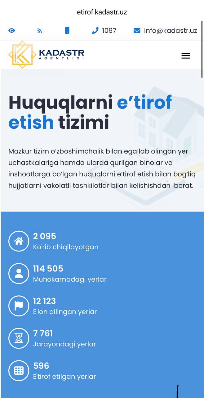


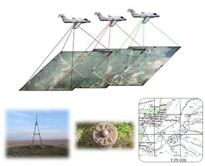
A total of 868 triangulation points (used in GPS, topography, orthophotoplane work) and 461 level markers (used in altitude detection) were inspected in Navoi region.
450 (used to determine altitude) level coordinates were determined.
(Object of Andijan, Namangan and Fergana regions) 6136 km2 (64 sheets) of Namangan region digital topographic maps with scale of 1:25 000 were created
In order to create 1:10,000 digital orthophotoplans of Syrdarya and Jizzakh regions, aerial photography was carried out using An-2 aircraft and DMC III aerial camera, and 230 1:10,000 digital orthophotoplans were created.